|

NOVITA'


MD MILITARE

cerca
servizi cerca cavi tubi
checkpoint
porta metalcerca servizi
termo camera

AUDIO HI-FI
Amplificatori
a valvole
Diffusori
acustici
 Visori
mirini notturni ottiche
Visori
mirini notturni ottiche

Strumenti
elettronici bonifica ambientale
contatori
geiger

API
COLTURA
 MONTAGGIO COMPO
NENTI
MONTAGGIO COMPO
NENTI
 Costruzioni
meccaniche modellismo a vapore giochi di latta
Costruzioni
meccaniche modellismo a vapore giochi di latta
radio
LA
STORIA
CONTATTI
ORDINI
| |
MAGNARADAR
THE NEW AND SPECIAL GEOPHISYCAL MAGNETIC
GEO
RADAR, THE MOST SENSIBILITY OF THE MARKET WITH MULTI SENSOR TECHNOLOGY, THIS
UNIT GIVE YOU PICTURES IN REAL TIME WHAT INSIDE IN THE SOIL DIRECLTY IN THE
NOTEBOOK SCREEN
RENTAL SERVICE USD 700 FOR
MONTH.
|
|
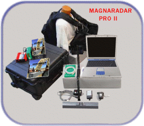
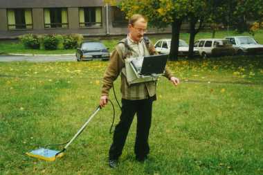
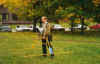
The MAGNARADAR PRO II comes complete with control
unit, sensor housing, extension shaft, battery charger, all connection
cables, carrying case, user manual, two hour demonstration by appointment
at our test facility. One year limited warranty.
|
|
Package price do not includes a pre-configured
Laptop computer, on demand we can preinstall the software in a laptop
computer |
|
MAGNARADAR PRO II
|
|
Pre-Configured Laptop
|
no
|
|
Dual Channel Control Unit
|

|
|
Field Pack
|
|
|
Wiring Harness
|
|
|
Cables
|
|
|
Battery 24V
|
|
|
Charger 24V
|
|
|
Software
|
|
|
Video
|
|
|
Extension Rod
|
|
|
User Manual
|
|
|
Tech Support
|
|
|
Pelican Case
|
|
|
Antenna Case
|
|
|
10" Sensor
|
|
|
GeoCaddy
|
no
|
|
20" Sensor
|
no
|
|
Retail
|
4500 euros + vat
|
|
|
|
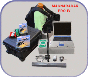
The MAGNARADAR PRO IV is a state of the art
Multi-Sensor array that is well suited for both the utility locator as
well as the professional treasure hunter. It has advanced software which
makes operating the unit and data analysis much simpler than other
brands available. The software renders a 3D representation of the
surveyed magnetic field.
|
|
The MAGNARADAR PRO IV is our entry priced
multi-sensor geophysical surveyor unit. provides the advantages
of our multi-sensor antennas at a lower price.
|

|
|
|
Package price not includes Laptop computer.*
on demand we can instal the sofware on your own Pentium 4 equivalent or
better |
|
MAGNARADAR PRO IV
|
|
Pre-Configured Laptop
|
no
|
|
Dual Channel Control Unit
|
|
|
Field Pack
|
|
|
Wiring Harness
|
|
|
Cables
|
|
|
Battery 24V
|
|
|
Charger 24V
|
|
|
Software
|
|
|
Video
|
|
|
Extension Rod
|
|
|
User Manual
|
|
|
Tech Support
|
|
|
Pelican Case
|
|
|
20" 4 Sensor Antenna
|
|
|
12" 4 Sensor Antenna
|
no
|
|
36" 4 Sensor Antenna
|
no
|
|
Geocaddy
|
no
|
|
Retail
|
6300 euro + vat
|
|
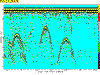
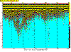
SCANNING EXAMPLE
3-D GeoRadar Surveyor Software
All Scans are actual without filtering.
|

|
|

click to enlarge
|
This is a south to north scan of our demonstration room showing buried
targets beneath the concrete floor.
|
|
|
|

click to enlarge
|
New discovery of a gold/silver vein with magnetite in
an older mine located on the U.S. west coast. Right side of scan was
done at a slower pace therefor the scans do not line up.
|
|
|
|

click to enlarge
|
Scan of a barrel buried at 2m and a 2' PVC pipe buried
at 2 feet. Pipe was filled with flour for a demonstration for Jackson
County Narcotics to simulate buried narcotics.
|
|
|
|

click to enlarge
|
A more focused scan of the barrel buried at 2m
|
|
|
|

click to enlarge
|
Scan taken from road of tunnel below.
|
|
|
|

click to enlarge
|
Gold plate scan going up hill across the
vein.
|
|
|
|

click to enlarge
|
Scan across gold/silver and pgm group metals found in
hydrothermal quartz vein.
|
|
|
|

click to enlarge
|
Scanning from south to north example of barrel scan
buried 6' below ground.
|
MAGNARADAR Underwater Scans at Lost Creek
Lake,
Oregon
|

|
Army Core of Engineers Data
Project Description
 |
Stream: Rogue River
|
Location: McLeod, Oregon
|
Type of Project: Storage
|
Authorized Purpose: Flood Control, Power,
Recreation, Irrigation
|
Other Uses: Fishery, Water Quality |
| | | |
|
Hydrologic Data
|
Drainage Area = 674 sq mi
|
Maximum inflow = 55,000 cfs (1964)
|
Lake Elevation
 |
Full pool = 1,872.0 ft
|
Minimum flood control pool = 1,812.0 ft
|
Minimum conservation pool = 1,751.0 ft |
| |
|
Usable storage (1,751.0 to 1,872.0) = 315,000 AF |
| | |
|
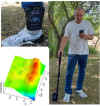
As the development of the units
continues, we have performed a underwater demonstration using many new
advancements of the antennas and technology. 
We started the day off by
selecting the 6 Foot Antenna to go with our adventure along with the Control
unit. The 6 foot Antenna is equipped with (8) High Sampling Sensors that are
capable of traveling high rates of speed.
To give you an example, we were
given a tip regarding an old sunken structural bridge at the bottom of the lake
(approx. 100 feet or more) We ventured on a (1) Row Scan traveling at a constant
speed of approx 30 MPH.  We then started the underwater scan allowing the sensors to ground balance
to the surrounding environment variables (i.e. the water's surface area.) We set
our software settings to a length of 200 (one of the highest settings of length
tested so far). As we were scanning we noticed mass changes in the software's 3D
imaging contours, and the sensors were responding according to plan. When the
scan was finished at the 200 length from within the software, we then took the
scan and rotated the image to show more detail from a lateral perspective then
to an oblique mode perspective.
We then started the underwater scan allowing the sensors to ground balance
to the surrounding environment variables (i.e. the water's surface area.) We set
our software settings to a length of 200 (one of the highest settings of length
tested so far). As we were scanning we noticed mass changes in the software's 3D
imaging contours, and the sensors were responding according to plan. When the
scan was finished at the 200 length from within the software, we then took the
scan and rotated the image to show more detail from a lateral perspective then
to an oblique mode perspective.
The Flat rotation of the image
portrayed a very high detailed image regarding the sensors response of the
highly-mineralized silt at the bottom of the lake, then continued to a sunken
perspective of the underwater bridge that we were looking for. From that point,
I then turned the image to the "Oblique" angle in the software to show
a more adept view in 3D still containing the same colors based on the data
received.
 At this point in the day, the weather was hot but we still
continued to make the most of this technological breakthrough of equipment and
ease of use. We ventured further across the lake to start the second scan of our
adventure. We then set the software this time to a smaller size of scanning
area, (50) sped up to a constant speed similar to the bridge scan, started the
software once again to cause the ground balancing to take effect and began
scanning. To our amazement when the scan completed, we noticed a huge difference
in the software that we hadn't seen yet. We saw the values in the image (blue)
as a bottom of the lake channel that we were traveling upon turn into a high
reading of magnetic qualities. (Red) We couldn't quite explain by definition
what it was that we saw. To our amazement while capturing photos of the trip
through the lake channel, we noticed the mineralized surrounding hillsides that
seemed to continue from the left side of the channel to the right side and guess
what? This high concentration was that of very highly mineralized iron-like soil,
silt and rock that continued right under the boat and directly under our sensors.
At this point in the day, the weather was hot but we still
continued to make the most of this technological breakthrough of equipment and
ease of use. We ventured further across the lake to start the second scan of our
adventure. We then set the software this time to a smaller size of scanning
area, (50) sped up to a constant speed similar to the bridge scan, started the
software once again to cause the ground balancing to take effect and began
scanning. To our amazement when the scan completed, we noticed a huge difference
in the software that we hadn't seen yet. We saw the values in the image (blue)
as a bottom of the lake channel that we were traveling upon turn into a high
reading of magnetic qualities. (Red) We couldn't quite explain by definition
what it was that we saw. To our amazement while capturing photos of the trip
through the lake channel, we noticed the mineralized surrounding hillsides that
seemed to continue from the left side of the channel to the right side and guess
what? This high concentration was that of very highly mineralized iron-like soil,
silt and rock that continued right under the boat and directly under our sensors.
Once again, in the midst of
testing and development, we have determined again that the uses of magnaradar
never ceases, first by proving a tip of a fallen structural bridge decades ago,
does really exist, to a highly concentrated mineralized belt that could prove
useful for precious elements mining. And at the end of it all, as sophisticated
as this equipment is, the ease of use was beyond amazing. Enough so that we soon
agreed we would be back. This time bringing more advancement of equipment and
more gas for the boat.
MAGNA
Depth Estimation and Target Pin Pointing
|
|
Pinpointer Technology Update magnapointer has
been relased! Call the number at the bottom of the page for an upgrade
cd for your pinpointer.
**Now available with magnaradar**
Our new Pinpointer system for the USA magnadara specially designed for
pin-point target locating and depth estimation. Great for pin-pointing
tunnels, utilities and other underground anomalies. See our PinPointer
data sheet and Instruction manual
Quick-Start Easy Use Card
1. Turn on control units power
2. Start laptop computer and start software
3. Make sure antenna and network cables are plugged in
4. Allow a few moments for programs to communicate with one another
5. When ready push Connect then Start to begin scanning
6. Keep antenna pointing down without turning, in the same direction(for
best results)
7. In the Southern Hemisphere, south to north scans will provide best
results.
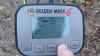
|
Current Reading - Very useful for
finding location of interest.
HIGH/LOW reading to distinguish between
targets and target approximation
Change Defaults (as needed) example:
For weaker targets set the high/low value to 10/-10 or 5/-5 for
even weaker anomalies.
Scans Per Second - Number of readings
per second may be increased for fast traveling.
Default - Resets values back to their
preset levels.
|
| |
Green- Background(common ground) |
| |
Blue - Negative Target(void, cave,
tunnel) |
| |
Yellow/Orange - Medium Target |
| |
Red - Strong Target |
|
| Pause often (Ground Balancing) every 1 or 2 minutes
to reset to zero and clear past readings.
| For Depth Estimation, find the high reading on the
target and walk away from target until you get 0 reading on the
PinPointer. Be sure the area you are walking away from is clear of
any higher than ground balance readings before testing depth.
| Measure distance from the balance reading to target
high mark, that distance will be the approximate depth of the target
| At time of pinpointing exact spot of interest, mark
on ground for reference |
| | |
|
|
|
The software: magnapointer |
| |
Blue - Weak Target (void, cave or
tunnel) |
|
Green- Background Targets (common
ground) |
|
Red - Strong Target (Metal Chest,
Metal Pipes) |
|
Current Reading - Current signal strength at the current
location.
HIGH/LOW - Lowest and Highest signal strength
for that scan.
Sensitivity Options - To pick up weaker targets
set these values lower. Ex. 10/-10 or 5/-5 for even weaker targets.
SPS - Number of scans per second. Increase for
faster traveling.
Default - Resets sensitivity values back to
preset.
Status Bar - Connected/Not Connected status.
|
send us your inquire, we will sent you all
informations, also user manual how work it mail to:
info@bravodog.com
o admin@wilsonelectronics.info Geophysical Exploration
Systems
GEORADAR system
12
|
to cliccare on
the photos in order to magnify them
|
There Georadar system 12, portable, of new
generation and elevated technology, centers it them radar e' the directly
interfacciata to notebook pentium with display to colors, in order to see what
e' in sottosuolo and relative stratografia to colors. Georadar system the 12 e'
indispensable for taken care of continuous and not destructive surveyings and
superficial visions and of the sottosuolo. For the searches they are not demands
diggings, not you e' risk to interrupt lines or pipages and are not necessary
cables to spread; only an antenna to pass on the land. The indispensable
Georadar e' for multiple applications: localization and optimization of
archaeological diggings, survey of I placed and buried objects, mines and
tunnel, controls of street paving, profiles of the sottosuolo, search of
stratums, fractures to you and cavita', glaciologia, survey pipages and cables
and areas sottosuolo contaminated. Used also in civil engineering for searches
of smottamenti and control of bridges, palaces and constructions in c.a.,
diggings prefoundations, ect
Technical characteristics: data visualize to
you in real Time on the display of the PC, Time range from 50 to 2000 nanosec,
transmit range: 115 KHz, adjustable gain, filters: verticall/horizontal low and
higt-pass filter, matched filter, inverse filter, migration filter, envelope
filter, median filter, ect. transfer given via rs-232C, feeding 12V Dc,
consumption 0,7 Ampere. Weight 3Kg. Elevated precision and resolution from first
cm. until 30 mt. of the sottosuolo with the aid of the following antennas:
unita' 2000 Mhz dimensions 27x13x13 cm and 1,5
weight Kg, of maximum precision until 2mt, unita' 900 MHz dimensions 43x22x2,
weight 2 kg, for profondita' until 5 mt. unita' to 500 MHz dim. 69x32x3 and
weight 4 kg for prospectings until 10mt, unita' 300 MHz dim. 98x52x4, weight 10
kg for prospectings until 15 mt, unita' to dipole in air from 150 MHz fine
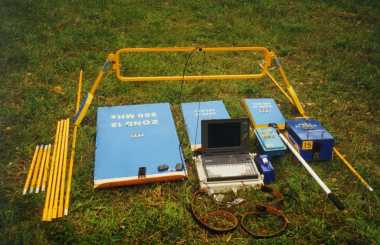
weight 6 kg for prospectings until 30 mt. The equipment radar composed standard
e' gives: it centers them operating radar, notebook with the special software
and operating handbook of management in English language, probe from 2000
interchanging MHz, battery and cables of connection.
Example of prospecting of three tubes buried in
the sottosuolo to one profondita' of approximately 1,2 mt. Every tube generates
marks having them the hyperbolic shape, to which appendix corresponds the exact
lease of the tube. The survey e' be executed with the antenna of sensibilita'
from 2000 MHz. And prospecting of ghiacciai. It encloses you to the equipment
radar are added to photo examples prospectings and surveys accompanied from
explanations. The equipment radars and relati software to you is always in
continuous development, for further information not hesitated to contact to us.
EURO 15400 while for the chartering e' available to 775 for 15 days.
| |

LA
LEGGE
GEORADAR
Z18
GEORADAR
IMAGER
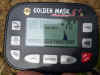
GOLDEN GM6
3D METAL DETECTOR VISIONARY
EVO6000
DETECTOR GRAFICO
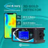
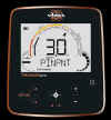
GAUSS MARS MD

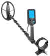
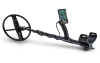
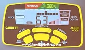
GARRETT APEX
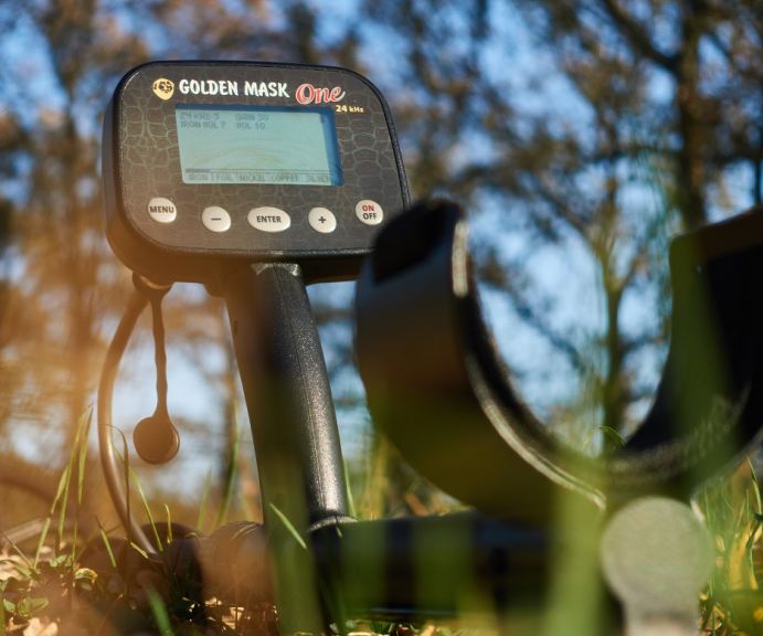
GM ONE
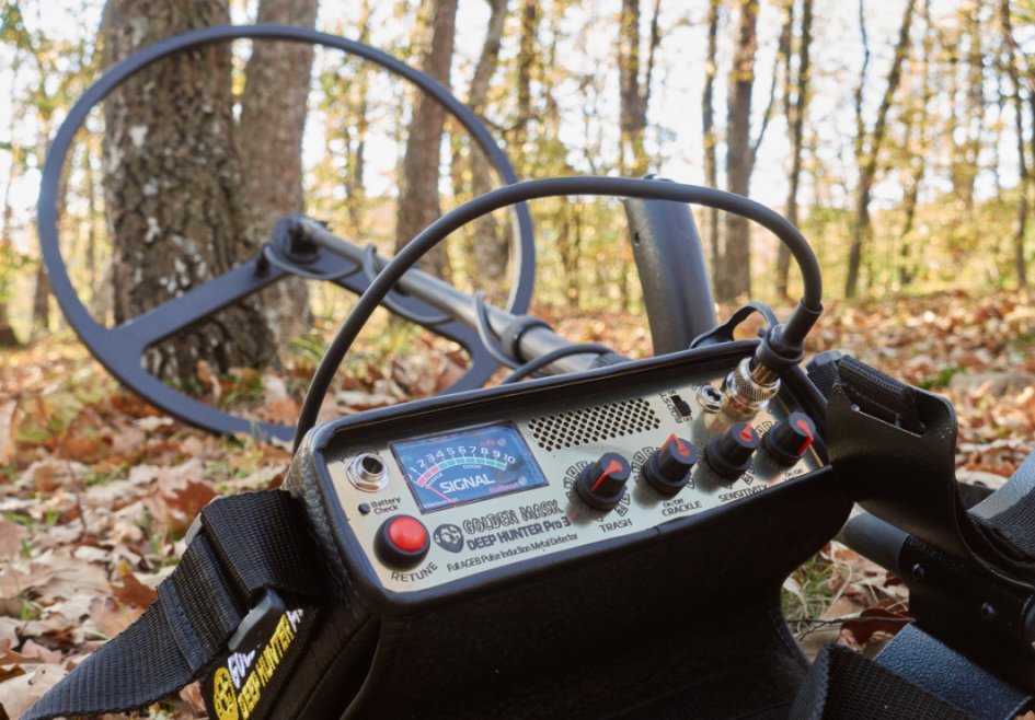
DEEP HUNTER
blisstool LTC64X 
apolonia gold
rutus argo
rutus alter 71
gm5+ se
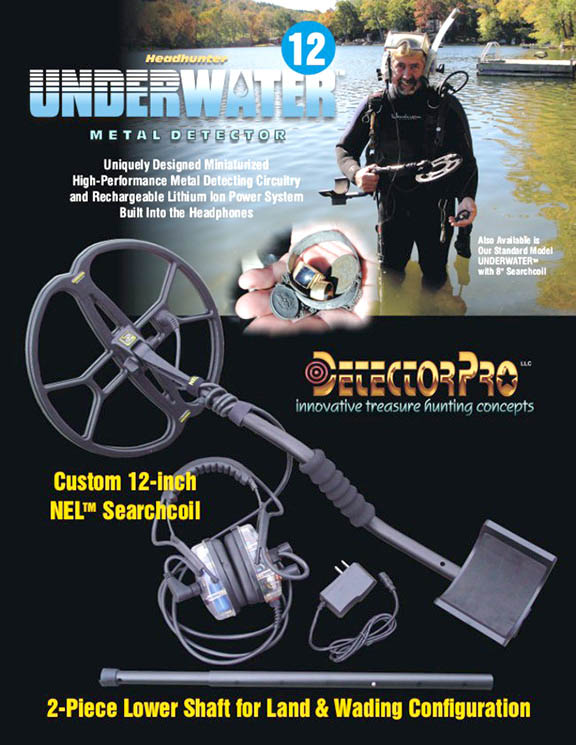
detectorpro 12DD sub
30mt
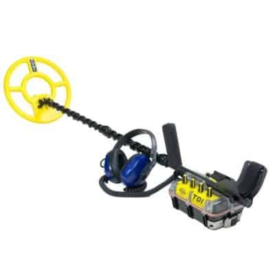
tdi beach hunter sub
garrett at max

viking vk40 240
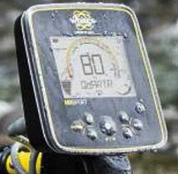
whites mx7
mini detector 210
340 golden mask 4wd
white's mx
sport sub
pulse hunter 8 metri da
profondita
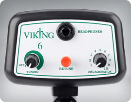
Viking 6 euro 120 nomotion
garrett 200i
300i 400i
white's treasure master

jeohunter
|


